Luzian Wolf, Klemens Wolf
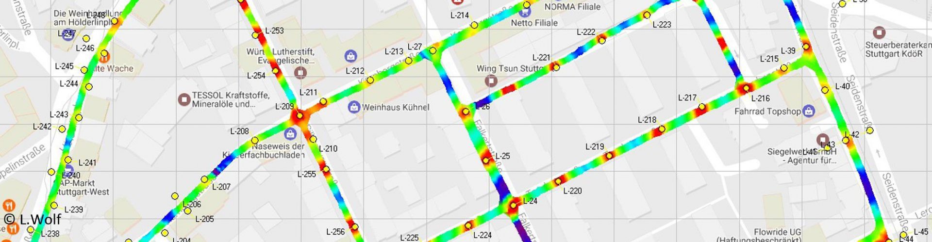
LimeCam is a lightweight, vehicle-mounted, multi-sensor system for measuring road illumination and generating key information for planning, verification, and quality control in related projects. LimeCam performs measurements at up to 80 km/h without the need to close off streets. Its measurement performance can also achieve as many as 200 light points per hour – many times faster than manual methods. LimeCam’s measurement results are presented to the customer in the form of a database with details on each light point (including geo-referenced positions, mounting heights, and local light distribution), as a graphical map, and as formatted text-based reports. The system uses Galileo GNSS and EGNOS for geo-referencing. Potential users of LimeCam include energy suppliers, urban service providers, engineering companies, light planners, and communities. They all can benefit from its key features:
› Practicable: A single instrument platform that mounts on any vehicle, no need to close off traffic, automatic data processing
› Fast: Vehicle speeds up to 80 km/h, up to 200 light points/h
› Safe: Protects operators in vehicles
› Data quality: Light point database, incl. maps and reports
Contact:
Luzian.wolf@object-tracker.com
www.object-tracker.com
The Expertise:
«Besides LimeCam, there is no vehicle-carried mobile mapping system so far for GNSS-based georeferencing of light points including illumination measurements for road lighting. In addition, energy suppliers and municipal service providers definitely ask for such a vehicle-based system capable for urban areas.»
Prof Dr Manfred Wieser
Deputy Director Institute of Navigation and Satellite Geodesy, Technical University Graz